The Coastal Resilience Center has launched a website to help communities plan for and evaluate hazards like hurricanes and wildfires.
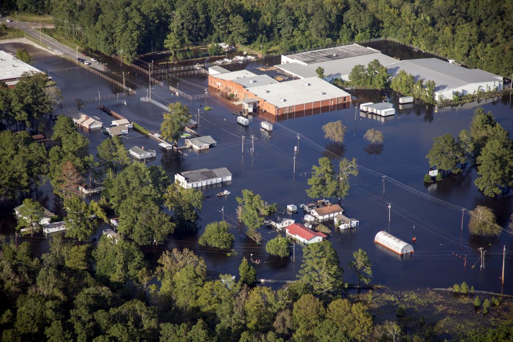
You know that part of your yard that turns into a small pond every time it rains? Or what about that plaza down the road that floods if someone even whispers the word “storm?” These water-logged areas may have been prevented with better planning. But now that they exist, what’s next?
That last question is the one local leaders across the country ask themselves when faced with repeated damage to specific areas of their communities from natural hazards. It takes a toll on infrastructure, the environment, the economy, and the people living there. It’s not easy to rebuild or relocate a family or business. And when it comes to community planning, collaboration and communication aren’t always top of mind.
“Local governments tend to act in siloed capacities,” says Phil Berke, research professor in the Department of City and Regional Planning in the UNC College of Arts and Sciences and member of the Coastal Resilience Center. “Planning, recovery, and prevention of recurring damage requires all the different parts of local government to work together.”
Berke’s research focuses on the relationship between community resilience and urban planning as it relates to natural hazards like hurricanes and wildfires. These events are occurring more frequently and with more severity due to the impacts of climate change, which can lead to continuous recovery efforts in some highly affected locations.
Berke and colleagues at Texas A&M University created the Plan Integration for Resilience Scorecard (PIRS) nearly 10 years ago to show gaps or conflicting efforts in a municipality’s departmental planning — like when an economic development team wants to build a new shopping center in a seemingly viable area of town that actually has a documented history of flooding.
A lack of cohesive planning also impacts individuals. There is no local government one-stop-shop for helping people who have been affected by these devastating events.
For example, if a street of homes in a flood-prone area becomes submerged for the third time in three years, one sector of government may want to relocate the families living there. But that requires involvement from multiple other sectors. Officials must find a place for the family to move to that is affordable and away from flood zones, which could involve land acquisition and the development of infrastructure like roads and sidewalks. The list of other potential needs goes on and on.
“These problems require integrative thinking across cities,” Berke says. “We’re getting to the point with climate change that it’s exacerbating everything. If we keep going at it at a one project at a time, reactive rather than proactively anticipating and looking at the community as a whole, we’re in trouble.”
Berke and his fellow researchers initially used PIRS on a case-by-case basis, working with eastern coastal communities impacted by hurricanes to guide them through the evaluation process and build better plans and communication tactics. They’ve since expanded their work across the country to work with California cities impacted by wildfires and are even providing guidance to leaders in Tokyo, Japan, who are working to mitigate issues caused by urban heat.
The latest advancements to PIRS happened this spring. With funding from the U.S. Department of Homeland Security (DHS), the Coastal Resilience Center, and a partnership with the American Planning Association (APA), PIRS got its own website. The tool, along with educational resources on how to use it, was made available online.
“PIRS started as a research project,” Berke says. “We wrote some publications and got some attention and awards. DHS wanted to see our theories translated into practice, and that’s what we’re doing.”
Berke and his collaborators have worked with APA to develop an e-learning platform on the PIRS website that engages community leaders in self-evaluation of their planning efforts. APA has also incorporated PIRS into its own operating procedures — an endorsement that will help the scorecard garner more users.
“We’re also beginning to see that this tool can be used as a platform of evidence for activist efforts,” Berke says. “In Houston, where redevelopment from hurricane Harvey hasn’t been equitably applied to all communities, residents have used PIRS as a data source.”
A local doctoral student started sifting through the Houston scorecard data after being contacted by residents who said no one believed their claims of inequity. Through their collaboration, the community members can now show city leaders their claims are reality.
“It’s yet another way to help communities ensure all their citizens are considered and protected when it comes to natural disasters.”
Phil Berke is a research professor in the Department of City and Regional Planning within the UNC College of Arts and Sciences, director of the Institute for the Environment’s Center for Community Resilience and the Environment, and a member of the Coastal Resilience Center.
By Carleigh Gabryel, UNC Research